The Arctic Coast Way opened on World Ocean Day, June 8, 2019. The road is 900 kilometers of coastal roads close to the Arctic Circle and mainly outside the main Ring Road. It takes you off the beaten track to discover some of North Iceland’s most remote locations. It is a one-of-a-kind adventure and runs from Hvammstangi in the west to Bakkafjörður in the east.
Nature’s force has carved a coastline of wild and pure beauty here, where volcanic land meets the icy ocean. Six peninsulas reach far into the sea, taking you from black sandy beaches to spectacular cliffs, along glacial river deltas and fjords to high mountains. Five stunning islands offer unforgettable experiences, and you will be able to cross the Arctic Circle. Each small town along the way has its own story about life on the Arctic’s edge.

You could drive the entire Arctic Coast Way in one go, but you don’t have to. You are free to take your time and enjoy the sights and sounds of the Arctic Coast Way. The dramatic shifts in light from the Midnight Sun to the Northern Lights and the seasonal color palette from winter’s pristine white to autumn’s fiery tones provide a new perspective each time, with new adventures awaiting you.
Interesting towns along the way
There are quite a few towns along the Arctic Coast Way, which you possibly wouldn’t visit if you kept to the Ring Road.
Hvammstangi
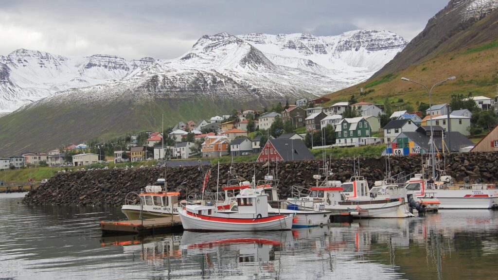
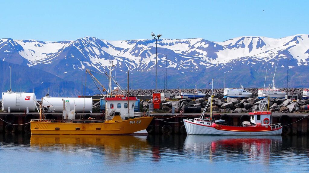
Hvammstangi is where the Arctic Coast Way starts and is the largest community in West Húnaþing (West Iceland) and has been a trading center for over a century. The Trade Museum will tell you everything you need to know about how people used to conduct their daily business in general stores.
The town has an excellent harbor to organize seal-watching and sea-angling trips.
Hvammstangi has a good swimming pool and a camping site with excellent facilities and electric hook-ups for trailer tents, campervans, and caravans.
Raufarhöfn
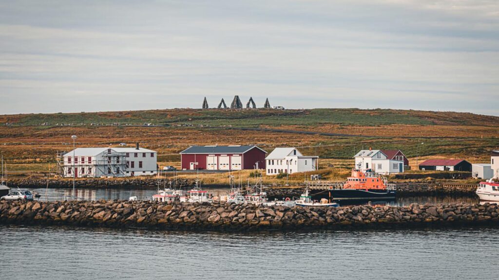
Raufarhöfn is Iceland’s northernmost town on the eastern shore of the Melrakkaslétta peninsula. Raufarhöfn, named after its natural harbor, was used for shipping from the beginning, according to the sagas. It was designated as a trading post in 1833, but the village did not form until 1875.
The herring fishery was a key factor in the village’s growth in the early twentieth century. By 1944, Raufarhöfn was Iceland’s second-largest herring station. The local population peaked at 500 in the late twentieth century. During the height of the herring boom, there could be up to 2000 migrant workers at any given time.
Raufarhöfn is now a peaceful little fishing village redefining itself. Raufarhöfn has all essential services and is a tranquil setting for walks, fishing, or birdwatching, as well as a front-row seat for viewing the midnight sun in summer and the northern lights in winter.
The Arctic Henge is being built on a slight elevation on the outskirts of the village. A massive stone sundial with allusions to mythology and folklore, designed to interact with the unique natural light in this arctic village. From there, it is easy to explore East Iceland.
Grenivík
Grenivík is located beneath the 1,173-meter-high Kaldbakur mountain. There are many excellent routes up the mountain. Still, if you don’t want to tackle those, there are more accessible paths up Engilhöfði, a 260-meter-high mountain just south of Grenivík. However, for those looking for a genuinely challenging climb, Blámannshattur and Laufáshnjúkur are both nearby.
Grímsey
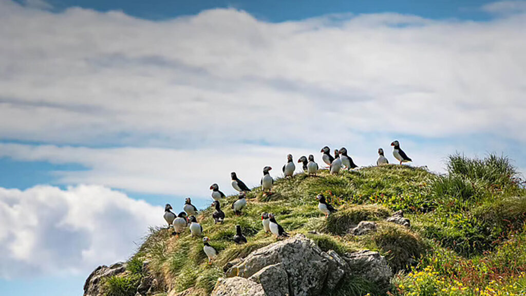
Grímsey is a green, grassy, and charming island, perhaps best known for its proximity to the Arctic Circle, which runs through the island. Many visitors come solely to cross that line from south to north. It is also one of the best places in Iceland to see puffins in the summer time.
The island is 5.3 km2 in area, its highest point is 105 meters, and the distance from “Iceland” is 41 km.
Life on Grímsey is bright and energetic, and the inhabitants are cheerful, working and playing with equal zeal. In 1989, a good swimming pool was built there. The island’s residents shop at the village store, Búðin, which is privately owned and sells a wide range of goods.
The Sæfari ferry runs three times a week from Dalvík to Grímsey annually. Icelandair also operates regular flights three times per week during the winter and seven days per week during the summer.
Bakkafjörður
Bakkafjörður revolves primarily around the sea’s fish and the right to survive by catching them!
Sea angling for cod is always a popular tourist activity. If the weather is nice, you should have no trouble convincing one of the fishermen to take you on a fishing trip in his boat. A walking trail leads from Viðvík to the Viðvíkurbjörg cliffs, then to Álftavatn, and finally to Bakkafjörður, where the birdlife is abundant and diverse.
Kópasker
Kópasker is a fishing village on the fjord’s eastern shore. The leading economy is based on services to local farms and fisheries. In Kópasker, the local museum at Snartarstaðir is worth a visit, as is the Earthquake Center, which describes the 1976 Earthquake.
Kópasker has a shop, a garage, a health care center, a bank, a campsite, and guesthouses. North of Kópasker is the bird-filled peninsula Melrakkaslétta and the northernmost point of mainland Iceland, Hraunhafnartangi.
Hjalteyri
Hjalteyri is a small village on Eyjafjörur’s western shores. This was one of the main hubs of the herring fishing industry until the early twentieth century. It is now an aquaculture center where research into the feasibility of halibut culture is conducted. During the summer, the buildings of the old herring factory are frequently used as a venue for art exhibitions. Because the famous geothermal struts are just offshore, Hjalteyri has some of the most exciting diving areas in the world.
Hauganes
Hauganes is located adjacent to Árskógsandur and is part of the Árskógsströnd coastal area in North Iceland. It is also the most southern community in the Dalvík district, with around 140 people. Like its neighbor Árskógssandur, this village primarily focuses on fishing and fish processing. In this small but appealing community, you can combine the luxury of experiencing a country atmosphere with the convenience of being within easy reach of larger towns. Akureyri is only a 20-minute drive away, and Dalvík, the area’s leading service center, is only a 10-minute drive away.
Ólafsfjörður
Ólafsfjörður has many interesting and enjoyable pursuits for both general tourists and those interested in outdoor activities.
It is a skier’s paradise and an outdoor enthusiast’s dream come true during winter. Cross-country skiing, slalom skiing, alpine skiing, skating, zooming around on a snowmobile, or ice fishing in the waters of Ólafsfjörður lake are all options. Main Street even has a ski jump ramp. Ólafsfjörður is ideal for alpine skiing because you can ski from a 1000m peak to the shoreline in virgin powder.
The black sandy shores with big waves attract Arctic Surfers, and you can say that Ólafsfjörður is one of the best places in the world for Northern Lights surfing.
Siglufjörður
Siglufjörður has various interesting and enjoyable things to do and see for tourists and those looking for outdoor activities.
The winter transforms the town into a skier’s paradise and an outdoor enthusiast’s dream. They can try cross-country skiing, slalom, skating, or zipping across the snow on a snowmobile.
A wide range of walks and hikes in the mountains and the valleys are accessible during the summer months. A few hours spent walking through the area’s rugged landscape allows one to savor its peace and tranquillity.
Hofsós
Hofsós is a small village located to the east of Skagafjörður fiord. This was once the region’s main service center and is one of Iceland’s oldest trading posts.
An old log building, Pakkhúsið, a warehouse from the Danish trade monopoly, can be found here (1602-1787). Another old building, which has recently been renovated, houses yet another museum, the Icelandic Emigration Center, which tells the story of Icelandic emigrants to North America.
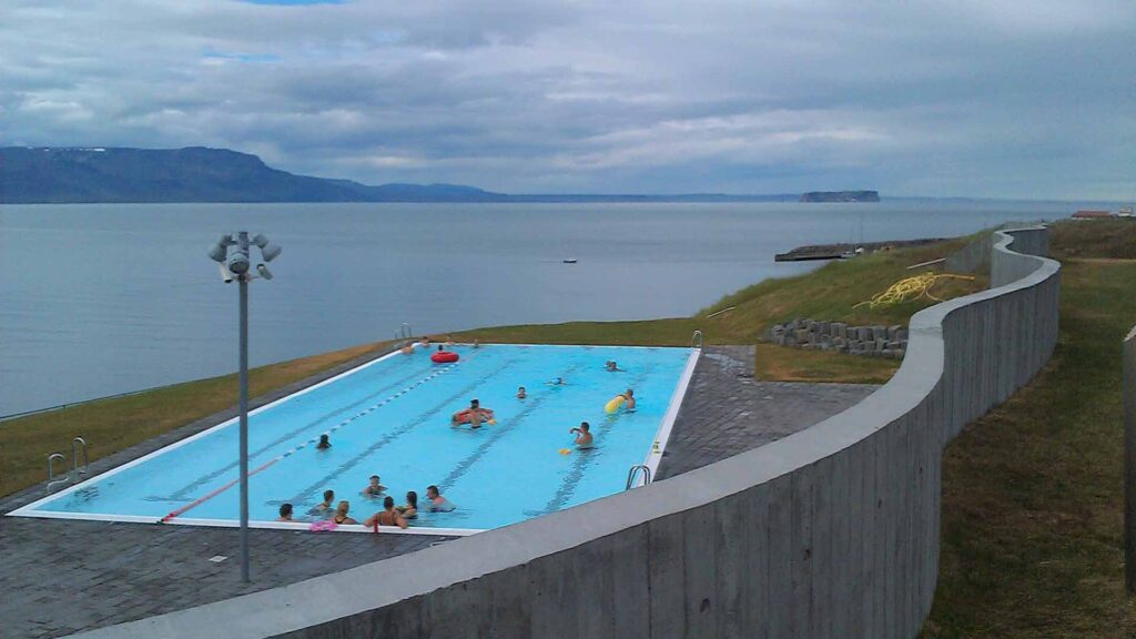
Sólvík Restaurant serves refreshments in a casual setting. There is a camping area and a guesthouse near the primary school. Hofsós’s new and impressive swimming pool opened on March 27, 2010. The new swimming pool and its surroundings are exquisitely designed. The pool is on the seashore, south of the village and above Staðarbjargarvík.
Hofsós hosts a festival on Midsummer’s Day.
Check out Lighthouses
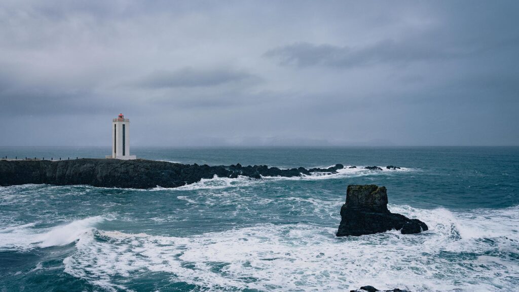
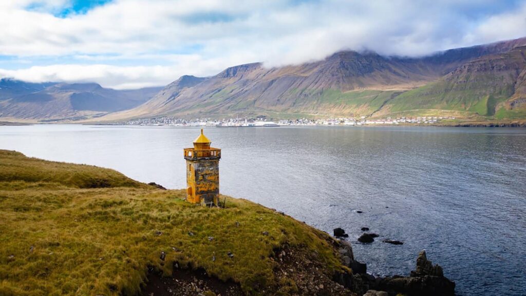
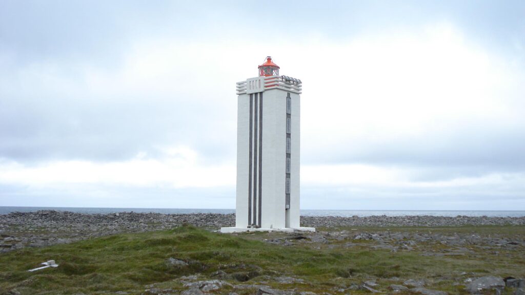
Lighthouses have been a popular feature to photograph. Understandably, they are usually situated in rugged areas where nature, shadows, and light play together – no matter the weather.
Kálfshamarsvík
Kálfshamarsvík is a small peninsula surrounded by spectacular basalt columns. The lighthouse is easily reached by car. A sign on gravel road No.745 directs visitors to the lighthouse. There is parking available as well as a rest area. Short walks provide opportunities to explore the surrounding area.
Selvíkurviti
A hike is required to reach the lighthouse. A “Ráeyri” sign indicates the exit from road No.76 at the fjord’s southern end. There are parking options at the end of the gravel road.
Grímsey Lighthouse
Grímsey can be reached by ferry or plane. A lovely walk along the island’s south coast leads to the lighthouse east of Grímsey. Between the middle of April and the middle of August, puffins and other birds feed on the cliffs.
Hraunhafnartangi
Hraunhafnartangi and Rifstangi are Iceland’s northernmost points, located on the arctic circle. The name Hraunhafnartangi comes from a natural harbor mentioned in 13th-century literature. The burial mound of Þorgeir Hávarsson, who was slain there in an epic 11th-century battle chronicled in Fóstbræðrasaga, is thought to be Þorgeirsdys, a stone mound found on Hraunhafnartangi.
Visitors who bring photographs of themselves by the Hraunhafnartangi lighthouse can obtain a certificate from local service providers certifying that they have visited Iceland’s northernmost point.
A sign on gravel road No. 870 points to the most northern point of Iceland’s mainland. A short walk along the coast leads to a rich birdlife. The Arctic Circle is only 3 kilometers away. Please exercise extreme caution if you climb the massive stones to “see” the Arctic Circle – the ocean occasionally sends strong waves, and the rocks are slippery.
The elder duck is legally protected in Iceland. Between April 15 and July 14, all access to the nesting area and its surroundings is prohibited.
Digranesviti
From Bakkafjörður to Digranesviti, there is a well-marked trail. The lighthouse stands 18.4 meters tall and was built between 1943 and 1947. It’s best to park your car in Bakkafjörður and walk to the abandoned farm Steintún; Digranesviti is about 1 km away. The hike is lovely, as is the view from the lighthouse. Take care as you walk across the cliffs to the lighthouse.
Go Seal Watching
You have heard of whale watching, but have you heard about seal watching? Hvammstangi and the surrounding area, including Vatnes, are among the best places to see seals in Iceland.
Seal Watching from Hvammstangi
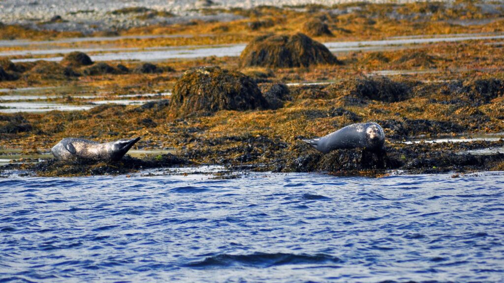
Seal watching is a novel experience in Icelandic tourism, and you can take boat trips from Hvammstangi. The trip goes around Miðfjörður and Húnaflói, allowing you to see seals, birds, and even whales in their natural habitat.
If you want something less structured, you can head to Illugastaðir or Ósar to see seals. There is a large parking area near Road 711, and an “Illugastaðir” sign indicates the way. It is a short walk to the beach, which provides excellent opportunities to observe seals in their natural habitat. Some of the best seal and bird watching in Iceland can be found near Ósar, 30 kilometers off the Ring Road on the Vatnsnes peninsula.
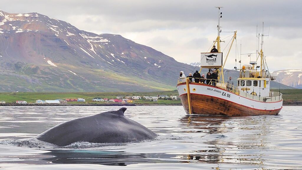
Go Whale watching
We, of course, recommend you go whale watching as well, as it is a spectacular experience. Húsavík has become one of the main places to go whale watching in Iceland, but it is also possible to take tours from Dalvík, Akureyri, and Hauganes.
Go Puffin Watching
You may see puffins on your whale-watching or seal-watching tours. If you want to see them, you can check out tours to Drangey. You can take a boat ride from Reykir harbor, close to Grettislaug, one of Iceland’s most famous natural hot springs.
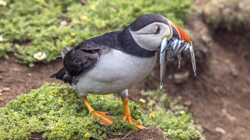
Additionally, you can go puffin spotting on your own. Take a trip out to Grímsey (and cross the Arctic Circle while you’re there) or go to Tjörnes Peninsula, which is about a 15-minute drive from Húsavík.
Check out our blog on the puffin to learn everything you need to know about this beautiful little bird.
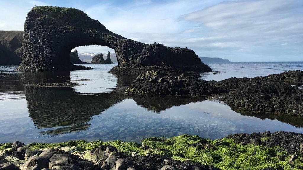
Check out the Sea Stacks
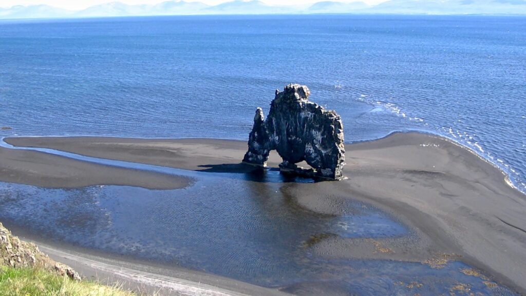
Sea stacks are possibly low on the list of things you must see in Iceland, but there are probably a few on your list. Like Hvítserkur – a famous rock formation to photograph.
On a short hike on the east end of Blönduós village, you will find the Karl sea stack.
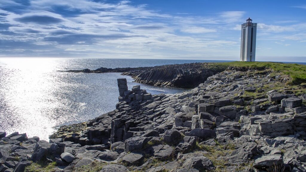
When you check out the Kálfshamarsvík lighthouse, you cannot miss the basalt columns surrounding it. It is pretty spectacular to see.
At Hofsós, you can also see beautiful basalt columns, and they’re just next to the swimming pool, which is highly recommended.
In Rauðanes, a sign on road no. 85 indicates a parking spot for the small peninsula. A hiking trail circles it, offering incredible views of the coast and sea stacks.
Langanes Peninsula is one of the most remote places in Iceland. To reach Stórkikarl sea stack, you must drive on a gravel road, no. 869. But it is worth the trip, especially for bird lovers, as a massive colony of Gannets nest on the rock. You might also see puffins, common murres, razorbills, fulmars, and black-legged kittiwakes.
North Iceland has many interesting places outside the Diamond Circle and other popular spots. We don’t want you to skip the Diamond Circle, but there are many other interesting places. The Arctic Coast Way is great for seeing rugged Iceland, small villages, and interesting sites. For further information, check out the website of Arctic Coast Way.