There are volcanic eruptions in Iceland fairly regularly. In the afternoon of the 3rd of August 2022, it started erupting again in Reykjanes Peninsula. It came after thousands of small and large earthquakes had been shaking the ground. This is what also happened last year when the eruption began then.

The new eruption is a fissure eruption, about 500 meters long in Meradalir. It is not far from the original eruption site in Geldingadalur.
How Can You Enjoy Eruptions in Iceland Safely?
If you are going to hike to the eruption site, it is important to take precautions, listen to the authorities and be respectful of nature. Iceland is beautiful but can be ruthless (despite it being pretty safe for tourists generally). Check The Icelandic Met Office (especially this site where you can see the gas forecast, Safe Travel and listen to the ICE-SAR people in the area.
History of Eruptions in Reykjanes
Volcanologists warned last year when the first eruption started in Geldingadalir that this could be the beginning of decades or even centuries of eruption. The last time it erupted in Reykjanes was in the 13th century; it had been erupting on and off for 30 years. But that was the end of an even longer series of eruptions that lasted about 300 years.

When it erupted in Fagradalsfjall last year, it was the first time in 6000 years. But there has been no eruption in Reykjanes Peninsula since 1240. Volcanologists say there are six volcanic systems in the peninsula; The Hengill Area, The Reykjanes System, Svartsengi (where the Blue Lagoon is, for example), The Krýsuvík System, The Brennisteinsfjöll System, and Fagradalsfjall.

Reykjanes lies on the mid-Atlantic Ridge, between the North American and Eurasian Tectonic Plates, which explains why the area is so active. The plates pull Iceland apart by about an inch per year (2,5 cm).
Iceland is one of the most geologically active places on Earth, but more than 15 volcanoes erupted in the last century. Since 2000 there have been 8 eruptions in Iceland.
- Hekla (South Iceland) in 2000
- Grímsvötn (in Vatnajökull Glacier) in 2004
- Fimmvörðuháls (by Eyjafjallajökull Glacier) in 2010
- Eyjafjallajökull Glacier in 2010
- Grímsvötn (in Vatnajökull Glacier) in 2011
- Holuhraun (North of Vatnajökull Glacier) in 2014-2015 – the 5th largest lava flows in Iceland since the settlement (85m2 in size).
- Fagradalsfjall (Geldingadalur – Reykjanes Peninsula) 2021
- Fagradalsfjall (Meradalur – Reykjanes Peninsula) 2022
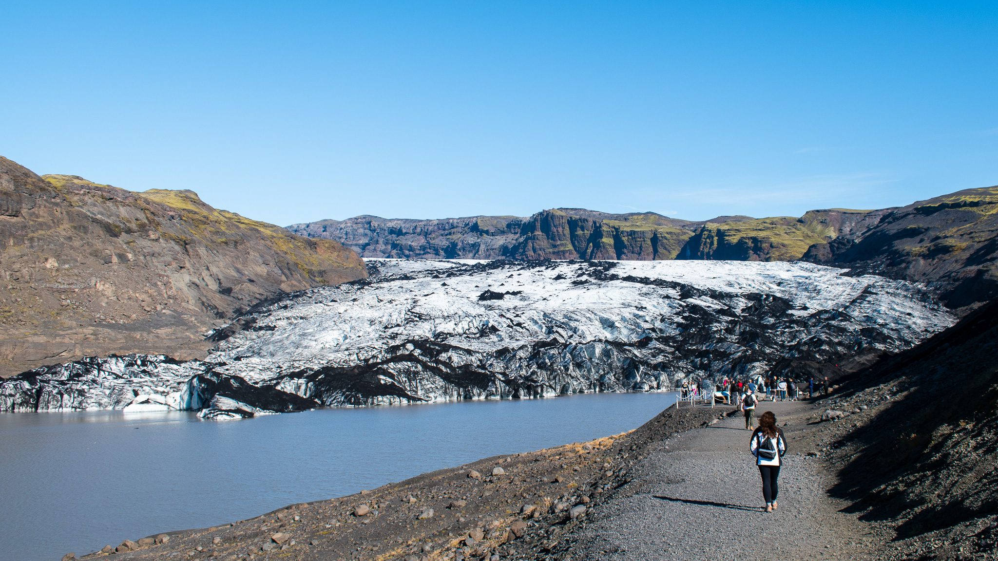
Hiking to the eruption site
The best viewing point is about a 17 km walk from the available parking lots. That is about 4-5 km further than the eruption last year. It is a strenuous walk, and you will have to be in good physical form to do the hike. You can also walk to other places, which are further away from the eruption and not as difficult.
You will have to pay for parking. It costs 1000ISK for 24 hours, and it is possible to pay for it using the Parka app.
You can take three pathways: A, B, and C.
Viewpoint A is at the end of trail A. It is the closest you can get to the new eruption, but it is the most difficult hike and will take most people 6-8 hours. Gas pollution is most likely at viewpoint A.
Viewpoint L is at the end of trail C. That hike takes 2-3 hours in total. The viewpoint offers a good view of the eruption and is at a safe distance. Viewpoint L is best for most people.
Viewpoint N is one of the easiest to reach. You can see and touch last year’s lava from that trail, but the new eruption cannot be seen from that viewpoint. This is the best option for you if you are not used to hiking.
For further information, check out Volcano Weather.
A new pathway was made recently. High sticks with grey reflective material mark it. The pathway is about 7 km long and gives a great view of the new eruption at the end.
What Should You Bring With You to the Iceland Eruption?
If you are going to the eruption site, be sure to be well dressed (in layers like always) and wear good hiking boots with ankle support. Have a headlight or some light source that is easy to use, enough food to last you, and if you have a chance, get a gas meter.
How to Enjoy Eruptions in Iceland in a Completely Safe Environment
Eldheimar
In Vestmannaeyjar, you can find a great museum called Eldheimar. It tells the story of the volcanic eruption on the main island, Heimaey, in 1973. The eruption is considered one of Iceland’s biggest natural disasters. In the museum, visitors get a glimpse into people’s lives on Heimaey before the eruption. The whole town had to be evacuated; it was just dumb luck that all fishing boats were docked at the harbor.
The eruption lasted 5 months, engulfed many houses, and the whole town got buried in volcanic ash.
The exhibition also covers the Surtsey eruption, the island which emerged from the ocean south of Heimaey in 1963. That eruption lasted almost 4 years, and to this day, only scientists are allowed to enter the island. It offers an excellent opportunity to monitor how new ecosystems come to life.
Lava Centre
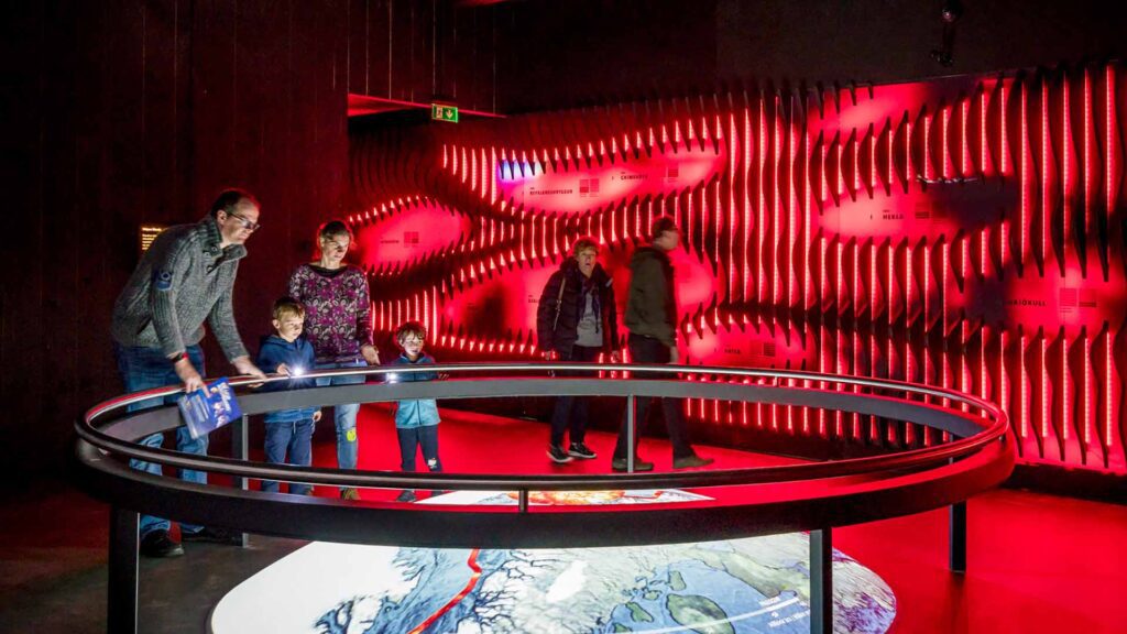
In Hvolsvöllur in South Iceland, you will find the Lava Centre. It is an interactive, high-tech educational exhibition that depicts volcanic activity, earthquakes, and the creation of Iceland over millions of years.
There are few tickets available, from buying a ticket to see the 15-minute volcano film, a complete experience, and a family pack ticket.
The Icelandic Lava Show

You will find the Icelandic Lava Show in Vík in Mýrdalur, not far from Reynisfjara Black Sand Beach. It is one of the best ways to experience real lava flow without going to an eruption. In fact, it is the only place where you can safely experience hot molten lava in close proximity, and there is no chance of gas pollution! The show recreates a volcano eruption, similar to what Eyjafjallajökull and Katla are famous for, by pouring the molten lava (1100° C / 2000° F) into the showroom and over ice.
Hveragerði Earthquake Exhibition
In the shopping mall in Hveragerði (right next to the Ring Road), you can find a small exhibition about the 2008 Earthquake (6,3 on the Richter Scale) that originated between Hveragerði and Selfoss. The exhibition shows you personal accounts from people who experienced the quake in the area, information about what it did to buildings, nearby surroundings, and people’s belongings. What’s most exciting, though, is that you can enter an earthquake simulator to experience the earthquake safely.
Please signup HERE for our newsletter for more fun facts and information about Iceland!


Hi which camera shows the route c view please?
Hi Sharon! None of the cameras specifically show one hiking route over another. The embedded map, however, shows the routes. If you press the small arrow in the upper left corner, you can choose what you see on the map (for example, just route C).